Development Strategy, Green Belt and Housing
This is one of the most important chapters in the Structure Plan. The Development Strategy balances the need for new housing and other development against the need to protect Hertfordshire's urban environment and the countryside.
The main policy of planned town regeneration aims to concentrate new development - particularly housing - within existing urban areas. This approach also aims to make best use of existing facilities, reduce the need to travel and to protect the Green Belt and countryside beyond from urban sprawl and other damaging development. This chapter also includes policies on the Green Belt, the distribution of housing between districts and strategic scale development locations, notably west of the A1(M) at Stevenage, to meet housing needs that cannot be met within existing urban areas.
POLICY 5 GREEN BELT
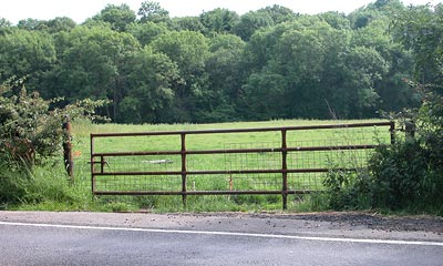
A Green Belt will be maintained in the south of the County as part of a Green Belt about 12-15 miles deep around London with limited extensions along the main radial corridors and around the towns, as indicated on the Key Diagram. The Green Belt will also be maintained in the County to the east of Luton, as part of the South Bedfordshire Green Belt. The precise boundaries of the Green Belt, as modified in accordance with the following provisions of this policy, shall be as defined in district local plans.
Boundaries of the Green Belt around towns may be reviewed in local plans to identify land at settlements listed in Policy 6 for the purposes of limited peripheral development under Policy 7. In addition, minor adjustments may be considered in reviews to secure a more sustainable pattern of development and activities within these settlements.
Individual adjustments linked to Policies 6 and 7 will need to be fully justified by reference to the criterion of exceptional circumstances indicated in Planning Policy Guidance Note 2 'Green Belts' (PPG2). Proposals should demonstrate that they contribute to sustainability objectives, and must be part of a comprehensive planning approach to deliver these objectives. In particular, housing, employment and retailing development will only be appropriate as part of this comprehensive approach, and where it can be clearly demonstrated that the relevant needs can best be accommodated by development as proposed.
Green Belt boundaries will be reviewed with an eye to exclusions to allow for the strategic housing developments for which provision is made under Policy 8. In the case of development west of the A1(M) at Stevenage the review will take account of the long term possibility of a total development of 10,000 dwellings. The following provisos apply to areas for exclusion:
- i. the limits of that west of the A1(M) at Stevenage shall be set north of Langley and Newton Wood, east of the B 656 and south of St Ippolyts, and be defined so as to preclude coalescence with nearby settlements;
- ii. those in Dacorum shall be on the periphery of Hemel Hempstead, subject to possible limited exclusions at Berkhamsted and Kings Langley; coalescence with Redbourn, Potten End and other nearby settlements is to be avoided.
Safeguarded Land
Any land released from the Green Belt in accordance with this policy but not planned for development during the period of the local plan should be safeguarded in that Plan, and generally referred to as 'safeguarded land' or as an 'area of special restraint'.
Green Belt Extensions
The Green Belt will be extended to include the following areas as indicated on the Key Diagram:
- i. an area in the neighbourhood of Markyate bounded by the existing Green Belt to the east, the Chilterns AONB to the west and the County boundary to the north;
- ii. an extension designed to contain development west of the A1(M) at Stevenage and bounded by the Metropolitan Green Belt to the south, the Luton Green Belt to the west and the A505 to the north.
POLICY 6 SETTLEMENT PATTERN AND URBAN CONCENTRATION
Development will generally be concentrated in the following settlements and in accordance with local plans:
Abbots Langley, Baldock, Berkhamsted, Bishop's Stortford, Borehamwood, Bushey, Cheshunt, Chorleywood, Croxley Green, Harpenden, Hatfield, Hemel Hempstead, Hertford, Hitchin, Hoddesdon, Letchworth, Potters Bar (including Little Heath), Radlett, Rickmansworth, Royston, Sawbridgeworth, South Oxhey, Carpenders Park and Eastbury, St Albans, Stevenage, Tring, Waltham Cross, Ware, Watford and Welwyn Garden City
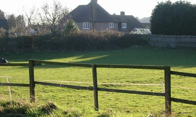
Other settlements may be selected in local plans within and beyond the Green Belt where limited development may be appropriate to maintain the vitality of the area. The identification of these settlements should demonstrate that sustainability objectives will be met by development which will take place. Within the Green Belt these settlements should be specified as inset (that is excluded from the Green Belt), where development will be limited to that which is compatible with the maintenance and enhancement of their character and the maintenance of their Green Belt boundary.
Development in smaller settlements, and in rural areas beyond the Green Belt, will be accommodated only to support the facilities and services needed and meet the employment and housing needs for that settlement and its surrounding area only.
POLICY 7 MAIN DEVELOPMENT STRATEGY
Development will be brought forward mainly through planned regeneration in the towns listed in Policy 6. Ways to increase the potential for high quality development through regeneration will be advanced and kept under continuous review in local plans.
Limited peripheral development will only be acceptable:
- i) where planned regeneration opportunities have been fully explored; and
- ii) where this can provide demonstrable sustainability benefits to the town; and
- iii) where this development is planned within the context of the town as a whole.
All proposals will be brought forward through the local plan process.
Proposals will be demonstrably practicable, based on the sustainability
aims and land use objectives set out in this plan and include wide community
involvement in the planning process.
POLICY 8 STRATEGIC LOCATIONS FOR SUPPLEMENTARY HOUSING DEVELOPMENT
Land suitable for strategic housing allocations, together with necessary associated development, will be identified in the following locations indicated on the Key Diagram and excluded from the Green Belt.
- Dacorum, Hemel Hempstead, 1,000 (at more than one location on the town periphery including land at North East Hemel Hempstead which is not Green Belt)
- Stevenage , West of A1(M) 1,000
- North Hertfordshire, West of A1(M), 2,600 at Stevenag
The planning of these developments will be brought forward through the review of the relevant local plans.
Master planning briefs will be prepared and negotiated with the developers. This shall be done by a joint local authority partnership of the relevant district and borough councils where more than one is affected. In the case of development west of the A1(M) at Stevenage, the partnership will include the County Council. Negotiations will have regard to Policy 2 in this Plan and all other relevant development plan policies.
In the case of the development west of the A1(M) at Stevenage, the master plan will provide for:
- i) an initial phase of 5,000 dwellings, some of which to be completed after 2011;
- ii) in the longer term, a possible second phase of a further 5,000 dwellings.
Providing that 3,600 dwellings in the initial phase are planned to be built by 2011, the detailed dwelling split at this location between North Hertfordshire District and Stevenage Borough will be determined in the relevant local plans, informed by agreed master planning work to establish the most sustainable form of development.
POLICY 9 DWELLING DISTRIBUTION, 1991 TO 2011
Local plans will make provision, in accordance with the development strategy as set out in Policies 6, 7 and 8, for a net increase in the period 1991 to 2011 of about 65,000 dwellings distributed as follows:
- Broxbourne - 5,400
- Dacorum - 7,200 - Includes 1,000 at more than one location on the periphery of Hemel Hempstead in accordance with Policy 8.
- East Hertfordshire - 11,100
- Hertsmere - 4,600
- North Hertfordshire - 10,400
- St Albans - 6,300
- Stevenage - 5,700 - Includes 1,000 west of A1(M).
- Three Rivers - 4,000
- Watford - 4,700
- Welwyn Hatfield - 5,600
- HERTFORDSHIRE - 65,000 - Of which 4,600 at strategic locations identified in Policy 8.
The exact dwelling allocations for North Hertfordshire and Stevenage may be varied between these two districts, depending on the dwelling split at the location to the west of the A1(M) in accordance with the provisions of Policy 8.
The County Council will review the need for alterations to this Plan when new Regional Planning Guidance for the South East is issued.
Hertfordshire County Council